Montclaire, Charlotte
Montclaire covers 2.4 square miles of Charlotte, and about 8,680 people live here. This page maps 38 parks and public places and 16 businesses inside its lines, most of them Food and Drink.

Living In Montclaire
Montclaire has about 8,680 people on 2.4 square miles, 3,658 per square mile, denser than Charlotte as a whole (2,778).
The median household earns $105,648 a year, 29% above the city median, #35 of 135 neighborhoods.
63% of homes are owned by the people living in them, and the median rent is $1,255 a month.
It is an older part of town: 43% of homes were built before 1960.
94% of homes have broadband internet.
Inside its lines: 25 trails and bike paths, 4 schools, 3 parks, 3 places of worship and 7 places to eat.
People
Money And Work
Housing
Getting Around
Connected
US Census Bureau American Community Survey 2020 to 2024, added up from the census tracts in Montclaire. Ranks count neighborhoods with 500 or more people.
Parks, Schools And Public Places In Montclaire
Trails And Bike Paths 25
- Ajewia Lake Loop
- Ajewia Lake Loop
- Backlot Trail
- Beginner Loop Connector
- Chunky Loop
- Farm Brook Loop Entrance
- Farmbrook Loop
- Farmbrook Loop Connector
- Little Sugar Creek Greenway (Construction)
- Middle Third
- Middle Third Entrance
- Mini Loop
13 more on the map below
Schools 4
- Collinswood Language Academy5621 Flagstaff Drive, Charlotte, NC 28210
- Montclaire Elementary School
- Smith Academy of International Languages
- Starmount Elementary School
Parks 3
- Little Sugar Creek Greenway
- Little Sugar Creek Greenway
- Park Road Park6220 Park Road, Charlotte, NC 28210
Places Of Worship 3
- Archdale Church of Christ2357 Archdale Drive, Charlotte, NC 28210
- Saint Andrew's United Methodist Church1901 Archdale Drive, Charlotte, NC 28210
- Saint Giles Presbyterian Church
Dog Parks 1
- Pet Station Dog Park
Landmarks And Historic Sites 1
- Abandoned Charlotte Delivery Service Truck and Car
Post Offices 1
- Starmount Post Office6241 South Boulevard, Charlotte, NC 28217
Places To Go In Montclaire
The most reviewed spots inside these lines, with photos where they have one.
Where To Eat
Businesses In Montclaire
Is yours missing or wrong? List or fix it free.
Food and Drink 7
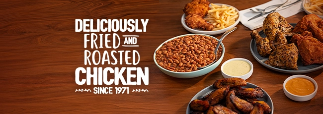 Pollo Campero | GuatemalanChicken restaurant
Lempira Restaurant - South Blvd.Latin American restaurant
 Curry GateIndian restaurant
- Cali Colombian Restaurant - South Blvd.Colombian restaurant
- McDonald'sFast food restaurant
- Romeo’s Vegan BurgersVegan restaurant
- 500 Degrees New York Style Pizzeria - South Blvd.Pizza restaurant
Shopping 4
 Ashley OutletFurniture store
 Ross Dress for LessClothing store
- Sleepy Poet Antique MallAntique furniture store
- Tyvola SquareShopping mall
Finance and Insurance 1
- National PawnPawn shop
Health and Medical 1
 StarMed Family CareMedical clinic
Parks and Recreation 1
- Park Road ParkPark
Groceries and Markets 1
 Food LionGrocery store
Auto 1
- Adams Auto GroupCar dealer
Own A Business In Charlotte
List it free on your neighborhood page in about two minutes. Townstoop is built by Clickflame, building local business sites since 2004.
Montclaire Questions
How many people live in Montclaire
About 8,680, from the Census American Community Survey tracts inside the Montclaire lines.
What parks are in Montclaire
3 mapped, including Little Sugar Creek Greenway, Little Sugar Creek Greenway, Park Road Park.
How many schools are in Montclaire
4 schools are mapped inside the neighborhood.
What is the rent like in Montclaire
The Census median gross rent is $1,255 a month, against $1,612 for all of Charlotte.
Do people rent or own in Montclaire
37% of homes are rented and 63% are owned, against 49% rented across Charlotte.
How do people get to work from Montclaire
The average commute is 22 minutes. 59% drive alone, 2% take transit, 2% walk and 26% work from home.
How old are the homes in Montclaire
43% were built before 1960 and 18% in 2010 or later. 68% are single family homes.
Is Montclaire a family neighborhood
24% of households have children and 23% of residents are under 18. 14% are 65 or older.
Sources, Census figures from the US Census Bureau American Community Survey five year estimates, parks, schools and public places from OpenStreetMap contributors (ODbL). How we build these pages.